How Roof Inspection with Drones Saves Time and Money
Why Roof Inspection with Drones Is Changing Roof Care
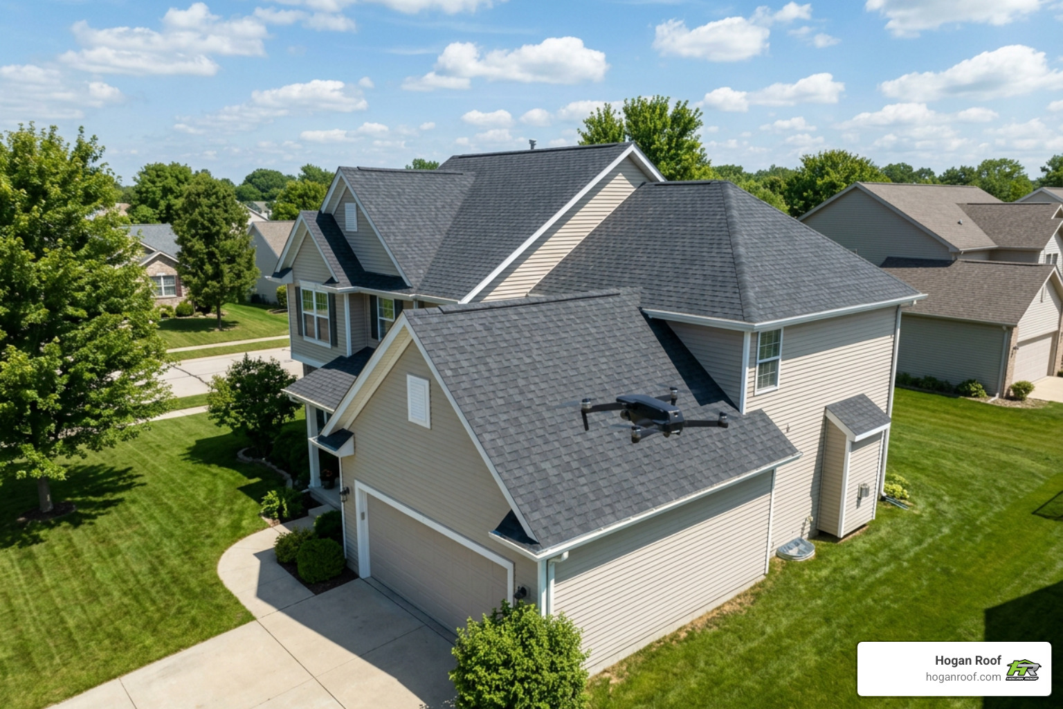
Roof inspection with drones uses a camera-equipped aircraft to photograph and assess hard-to-reach roof areas without sending someone onto the roof. It gives homeowners and business owners a clear view of issues such as missing shingles, damaged flashing, blocked gutters, storm damage, and wear around chimneys or skylights.
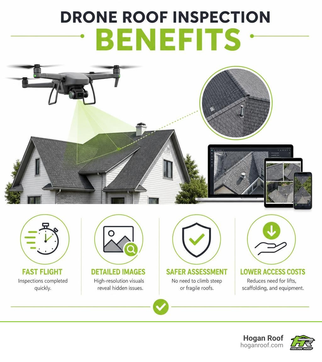
- Fast: Many residential flights take about 30 to 60 minutes.
- Safer: Inspectors can examine steep, fragile, or high roofs without unnecessary climbing.
- Detailed: High-resolution images can reveal defects that cannot be seen from the ground.
- Cost-conscious: Drone inspections can reduce the need for scaffolding, lifts, and other costly access equipment.
For an aging roof, a recent storm, or a suspected leak, this approach creates useful visual evidence before repair decisions are made. A drone inspection does not replace every hands-on test, but it can make the next step more focused, safer, and easier to understand.
I’m Bill Hogan, owner of Hogan Roof, and I have more than 20 years of experience helping residential and commercial property owners across the NY/NJ/CT tri-state area evaluate roofing problems. In this guide, I’ll explain how roof inspection with drones can support smarter maintenance and repair planning.
Understanding Roof Inspection with Drones: Technology and Workflow
A drone roof inspection is far more than flying a recreational quadcopter over a house and taking a few snapshots. In professional commercial applications, it is a systematic, tech-driven process that pairs unmanned aerial vehicles (UAVs) with high-resolution visual and thermal imaging sensors.
Modern drones capture anywhere from 200 to 400 overlapping images on a typical 10,000-square-foot roof surface. These individual photos are processed using specialized photogrammetry software to reconstruct precise 2D orthomosaic maps and 3D digital models. By stitching images together using shared visual landmarks and GPS tags, photogrammetry provides a comprehensive digital view of the entire roof.

To achieve pinpoint accuracy, professional systems leverage Real-Time Kinematic (RTK) positioning technology alongside mechanical camera shutters. RTK overrides standard satellite GPS drift by connecting to ground base stations, delivering centimeter-level positioning accuracy across every frame. This precision allows us to detect micro-cracks, slate shifts, and joint separations as fine as a millimeter.
By following pre-programmed flight paths at altitudes between 50 and 100 feet above the roofline, automated flight profiles ensure uniform coverage, consistent image overlap (typically 70–80%), and optimal focal distance.
Preparing for a Roof Inspection with Drones
Before a drone takes off, extensive pre-flight planning guarantees safety, legal compliance, and reliable data capture. Commercial operators in the United States must strictly adhere to Federal Aviation Administration (FAA) Part 107 regulations. Flying a drone commercially without an FAA Part 107 Remote Pilot Certification violates federal aviation laws and invalidates project insurance.
Safety and compliance prep includes:
- Airspace Clearance & LAANC Authorization: If a property sits near an airport or controlled airspace, flight authorization must be granted through the Low Altitude Authorization and Notification Capability (LAANC) system.
- Property & Privacy Site Assessments: Pre-flight physical assessments verify obstacles like high-voltage power lines, overhanging trees, and neighboring structures while respecting adjacent property privacy.
- Risk Assessments and Method Statements (RAMS): Detailed hazard evaluations dictate safe launch pads and emergency return-to-home parameters.
- Equipment & Sensor Calibration: Checking compass settings, obstacle-avoidance sensors, and dual recording systems ensures backup data redundancy.
Proactive roof management prevents minor weathering from becoming a costly structural leak. Explore roof maintenance services to see how routine aerial monitoring safeguards your property asset value.
Advanced Drone Hardware and Sensor Capabilities
The quality of an aerial inspection depends on the payload carried by the aircraft. Modern commercial inspection aircraft carry sophisticated dual-sensor payloads that combine visual and thermal optics.
High-resolution visual cameras carrying 20 to 50-megapixel CMOS sensors capture ultra-HD photos that reveal missing shingle granules, open seams, and fastener back-outs. Meanwhile, radiometric thermal sensors measure exact surface temperatures across flat and low-slope roofs.
By detecting subtle temperature anomalies, thermal imaging highlights damp insulation, subsurface moisture pooling, and structural thermal bridging that standard visual inspections miss entirely. For further research on aerial surveying standards, read about Drone Survey & Aerial Inspection Services Across the UK & Ireland | Norelo — Norelo.
Financial and Safety Advantages over Traditional Methods
Traditional roof assessments historically rely on manual climbing, extension ladders, scaffolding, or motorized boom lifts. These access methods bring notable safety risks, high operational overhead, and labor costs. According to Occupational Safety and Health Administration (OSHA) data, falls from heights remain the leading cause of construction-related work fatalities. Conducting a roof inspection with drones mitigates these fall hazards by keeping technical personnel safely on the ground.
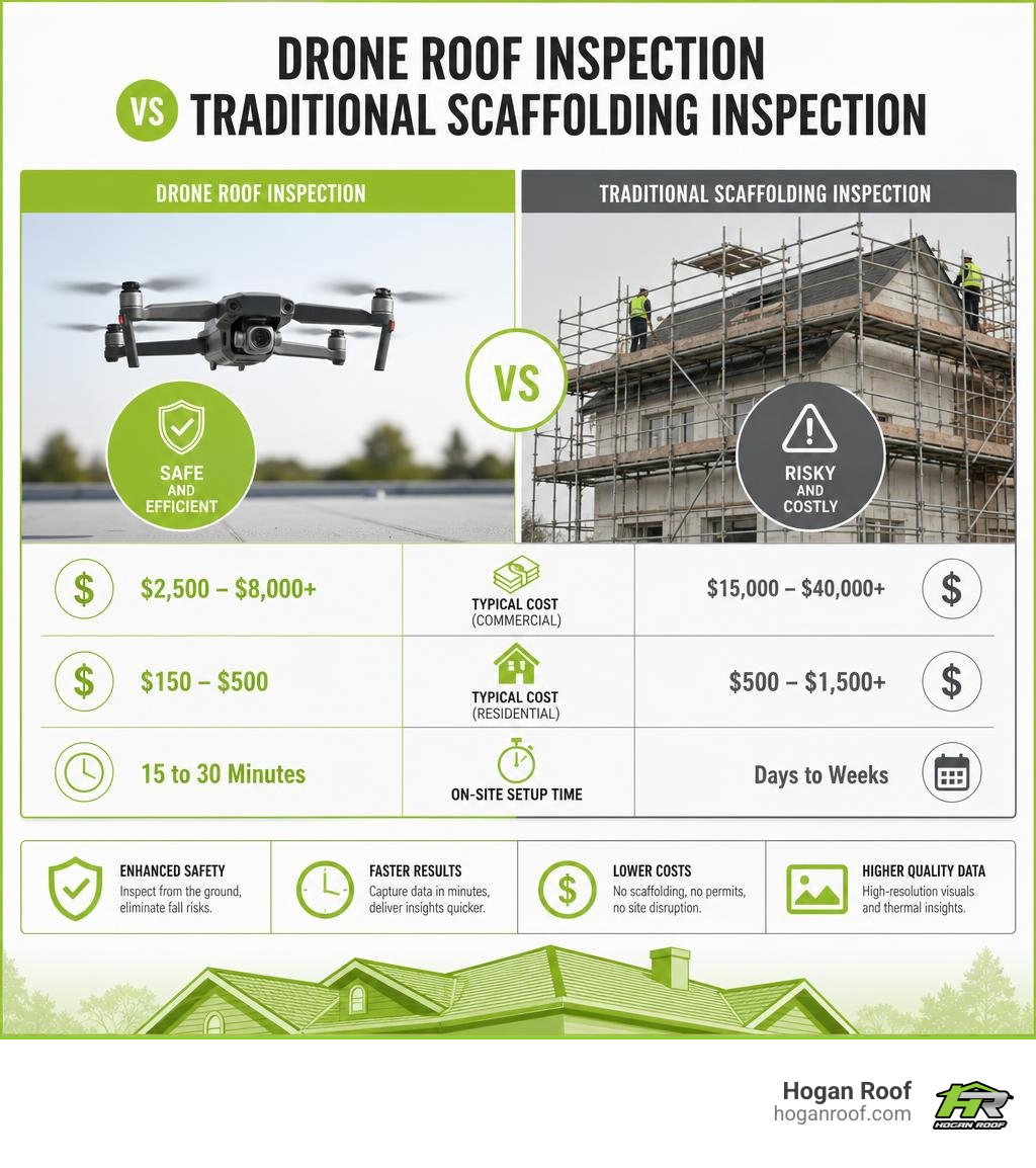
Beyond worker protection, drone assessments offer significant financial benefits for commercial facility managers and homeowners alike. Setting up traditional scaffolding around a commercial property can cost anywhere between $15,000 and $40,000+ in permits, equipment rentals, and labor. Conversely, drone operations require zero physical rigging, zero site disruption, and zero structural risk to fragile roofing materials like clay tiles, slate, or weathered glass skylights.
| Inspection Metric | Traditional Scaffolding Method | Drone Aerial Inspection |
|---|---|---|
| Typical Cost (Commercial) | $15,000 – $40,000+ | $2,500 – $8,000+ |
| Typical Cost (Residential) | $500 – $1,500+ | $150 – $500 |
| On-Site Setup Time | Days to Weeks | 15 to 30 Minutes |
| Flight/Inspection Duration | 1 to 3 Days | 30 to 60 Minutes |
| Safety / Fall Risk | High Risk (Working at height) | Zero Fall Risk (Ground pilot) |
| Roof Damage Risk | Moderate (Foot traffic wear) | None (Contactless flight) |
| Data Deliverables | Manual photos ¬tes | 3D models, orthomosaics, thermal maps |
Why Property Owners Choose Roof Inspection with Drones
Homeowners and property managers select drone inspections because they deliver speed, comprehensive data, and unbeatable cost efficiency. A residential flight that takes under an hour generates hundreds of geo-tagged, high-resolution visual data points.
Key reasons property owners favor drone-led surveys include:
- Zero Material Damage: Walking on slate, fragile clay tile, or aging asphalt shingles can break tiles and accelerate surface wear. Drones capture data without touching the roof.
- Accessing Unreachable Heights: Steep-pitched gables, multi-story commercial towers, and unstable post-storm structures can be safely evaluated.
- Rapid On-Site Execution: Most residential flights wrap up in 30 to 60 minutes, delivering clear inspection photos in just a few business days.
- Historical Baseline Tracking: Digital orthomosaic maps stored over time allow property owners to monitor wear year after year.
If you are planning an upgrade or need to evaluate residential shingle wear, learn about residential roofing options tailored to your local weather conditions.
Cost Breakdown: Residential vs. Commercial Property Savings
The direct savings achieved by replacing traditional physical access methods with drones can range from 70% to 80%. Pilot earnings reflect this efficiency, with operators commanding $100–$300 per residential property survey and over $500 for larger commercial structures.
- Residential Visual Inspection: Typically ranges between $150 and $500 , depending on roof square footage, pitch steepness, and building complexity.
- Residential Visual + Thermal Inspection: Ranging from $300 to $700 , this option adds thermal leak detection to pinpoint trapped moisture.
- Commercial Building Inspection (<50k sq ft): Ranges from $2,500 to $5,000 , delivering full 3D photogrammetry maps, elevation plans, and defect tagging.
- Commercial Building Inspection (50k+ sq ft): Ranges from $5,000 to $8,000+ , offering comprehensive thermal analysis, CAD structural exports, and multi-angle orthomosaics.
To review budget-friendly inspection programs and flat-rate replacement quotes, check out our transparent pricing options.
Detectable Defects and Processing Software
A drone high in the sky captures roof defects that remain invisible from ground level. By combining vertical overhead angle capture with close-range perimeter sweeps (3–5 meters away), an aerial inspection detects subtle mechanical wear, material degradation, and weather damage.
Commonly identified defects include:
- Storm & Hail Impact: Fractured asphalt shingle mats, dented metal seams, shattered tile corners, and dislodged ridge caps.
- Membrane Blistering & Seam Failures: Separated lap joints, membrane tenting, exposed underlying scrim, and split waterproofing layers on flat commercial roofs.
- Flashing & Parapet Separation: Cracking sealant, loose counter-flashing, and deteriorating mortar joints around chimneys, skylights, and parapet walls.
- Drainage Blockages & Ponding Water: Clogged internal drains, standing water pools, and sagging gutter channels.
- Soffit & Fascia Rot: Wood decay, pest entry points, and moisture damage concealed beneath wide eaves.
Uncovering Hidden Structural Damage and Leaks
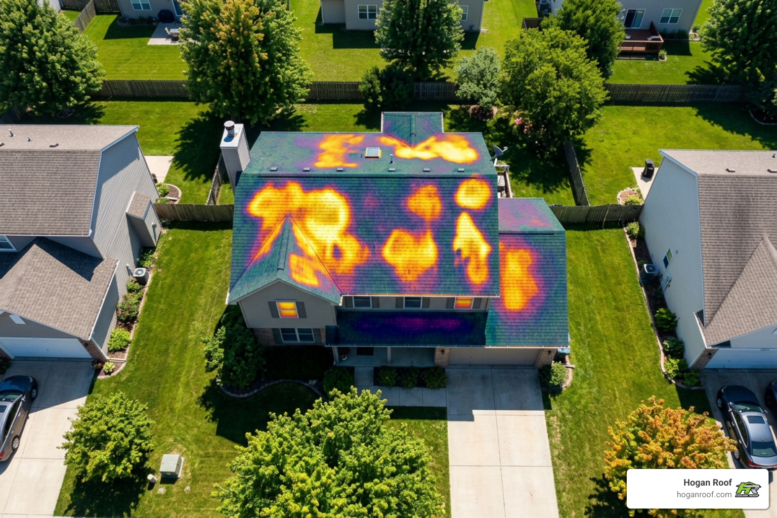
Visual cameras capture obvious surface damage, but subsurface moisture requires specialized radiometric thermal imaging. Trapped water under flat roof membranes holds heat longer into the evening than dry roofing materials.
To accurately capture these thermal signatures, flights are conducted during early morning or late evening when a surface-to-ambient temperature differential ($\Delta T$) of at least 10°C exists. Radiometric infrared sensors record these temperature variations across every pixel, pinpointing moisture trapped behind single-ply membranes and saturated insulation layers before indoor water leaks appear. For technical insights into thermal imaging workflows, review this guide on Drone Building & Roof Inspection Ireland | 8K Thermal.
Software Deliverables and 3D Modeling
Raw aerial images must be transformed into actionable engineering reports. Inspection data is uploaded to advanced cloud photogrammetry applications (such as DJI Terra, Pix4D, or DroneDeploy) to compile detailed property assessments.
The resulting reports deliver:
- Orthomosaic Maps: High-resolution, geometric, 2D overhead maps that allow millimeter-accurate spatial measurements without optical lens distortion.
- 3D Digital Twins: Interactive 3D structural models used by architects, engineers, and loss adjusters to view building envelopes from any angle.
- AI Defect Classification: Artificial intelligence machine-learning algorithms automatically scan images, flag anomalies (such as crack widths or rust areas), assign severity tags (e.g., Critical, Short-Term, Monitor), and record exact GPS coordinates.
- Annotated PDF Reports: Clear, comprehensive summaries detailing flagged repairs, thermal side-by-side overlays, and prioritized repair cost estimates.
To understand how high-resolution aerial data integrates with commercial building management, view the overview at StratoSight Thank you - NAES.
Frequently Asked Questions About Drone Roof Inspections
How long does a drone roof inspection take?
On-site flight operations for a residential property usually take between 30 and 60 minutes . Commercial inspections take anywhere from 2 to 8 hours depending on building square footage and layout complexity. Once flight data is uploaded, post-processing photogrammetry and AI defect analysis generate a complete PDF report within 1 to 3 business days.
Will an insurance company accept drone inspection reports?
Yes, virtually all major insurance providers accept and even encourage drone inspection reports. Reports containing geolocated photos, exact time stamps, radiometric thermal scans, and high-definition visual evidence provide indisputable documentation for storm damage and pre-loss insurance claims. To learn more about standard industry cost models and claim workflows, consult the Drone Roof Inspection Guide 2026 | Cost, Process & Benefits.
What weather conditions prevent a drone inspection?
Drone flights require clear, stable weather conditions to guarantee flight safety and image clarity. Flights must be rescheduled if:
- Wind speeds exceed 20 to 25 mph.
- Active precipitation (rain, sleet, or snow) is present.
- Dense fog or cloud cover reduces visual line-of-sight visibility.
- Temperature differentials fall below the 10°C $\Delta T$ required for thermal leak scans.
Conclusion
Roof inspection with drones has modernized how property owners protect their investments. By combining advanced camera sensors, radiometric thermal scanning, automated flight paths, and photogrammetry processing software, drone assessments cut inspection costs by up to 80% while eliminating worker fall risks. Whether you are dealing with post-storm damage, managing a commercial building portfolio, or conducting routine residential upkeep, aerial technology delivers accurate data in a fraction of the time required by traditional methods.
At Hogan Roof, we bring over 20 years of hands-on experience as an Owens Corning Platinum Preferred Contractor serving property owners across the NY/NJ/CT tri-state area. We combine modern drone inspection tools with proven trade craftsmanship to identify leaks early and extend your roof's service life.
Ready to evaluate your building with precision aerial imaging? Schedule expert roofing services today or request an Instant Roof Quote to get started! Have additional questions? Feel free to visit our About page, explore our recent project updates on the Blog, or directly reach out on our Contact page.